GTA 6 Map & Leonida Regions
    Six official regions

    GTA 6 Map & Leonida Regions

    A source-led atlas of the places Rockstar has named—and the boundaries it has not.

    Key Takeaways

    • Rockstar's official world material names six regions: Vice City, Leonida Keys, Grassrivers, Port Gellhorn, Ambrosia and Mount Kalaga National Park.
    • No official full map, square-mile area, county structure, road network or GTA V size multiplier has been published.
    • This atlas separates Rockstar-published geography from observations and community reconstruction.
    • Every regional image below is an official GTA VI screenshot stored locally on this site.

    Most GTA 6 map pages answer an unknown with a confident-looking fan image. That is useful for speculation, but not for planning around facts. Rockstar has revealed a broad state-level journey—from a dense coastal city and tropical islands to wetlands, faded roadside towns, industrial country and a northern national park—without publishing the final shape that connects them.

    This page starts with the evidence that can survive launch day: Rockstar's place names, descriptions and screenshots. Community mapping remains available as a separate interpretive layer, never as a substitute for an official map.

    The Six Official Regions

    Published geography first; assumptions clearly fenced off

    Official GTA VI screenshot of Vice City
    Official screenshot
    Metropolitan coreOfficially named

    Vice City

    Glamour, hustle and greed

    Rockstar names Ocean Beach, Little Cuba, the Tisha-Wocka flea market and VC Port while describing a city that stretches from art deco hotels and white sand to working neighborhoods and cruise terminals.

    Ocean BeachLittle CubaTisha-Wocka flea marketVC Port

    Still unknown: Rockstar has not published district boundaries, a street list, transit routes or a complete city map.
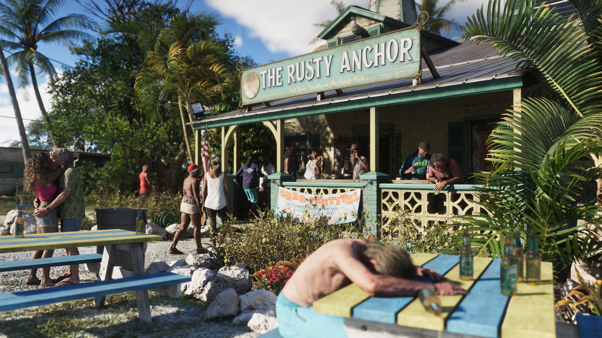
    Official GTA VI screenshot of Leonida Keys
    Official screenshot
    Tropical archipelagoOfficially named

    Leonida Keys

    Easy living beside dangerous water

    The Keys are presented as a laid-back island chain with casual bars, local life and immediate access to some of America's most beautiful and dangerous waters.

    Island settlementsBars and waterfront lifeBoats and seaplanesMarine wildlife

    Still unknown: The number of islands, bridge network, diving systems and exact relationship to Vice City remain unpublished.

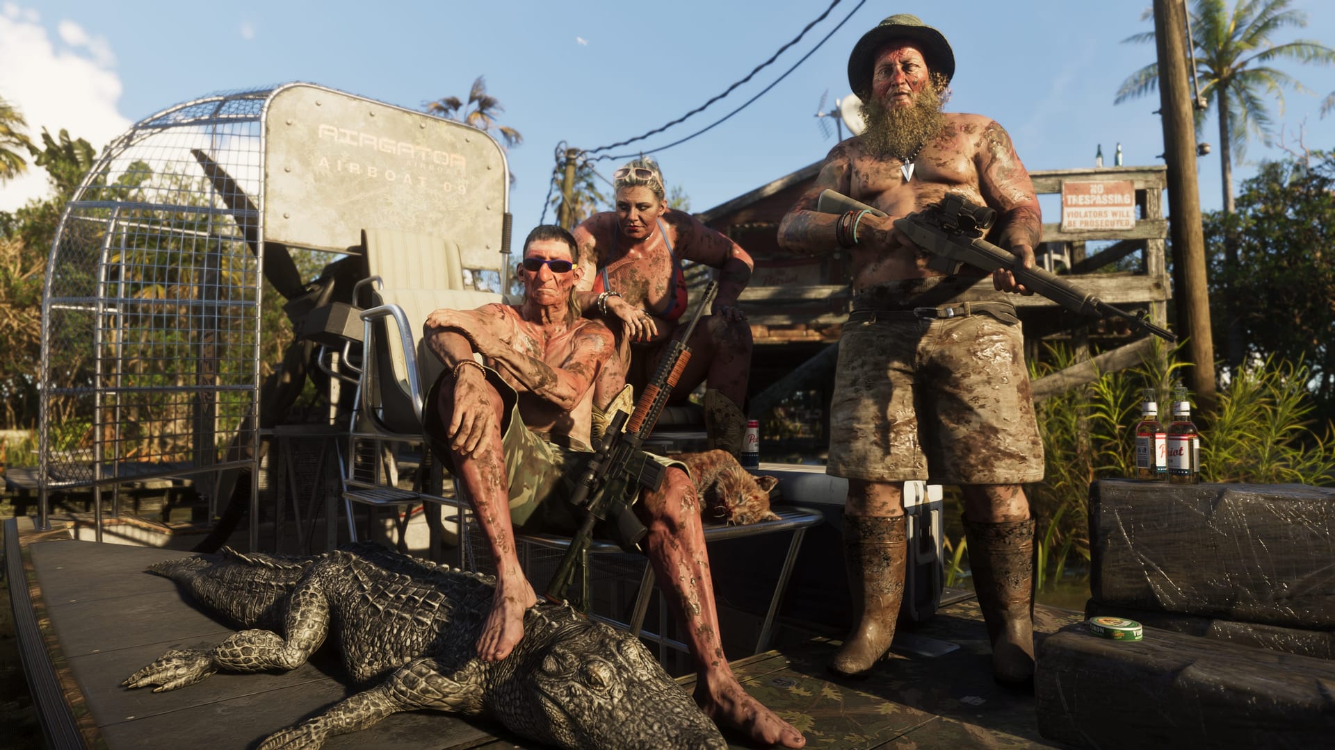
    Official GTA VI screenshot of Grassrivers
    Official screenshot
    Wetland interiorOfficially named

    Grassrivers

    Leonida's untamable wetlands

    Rockstar describes a primordial mangrove expanse where alligators are famous but not necessarily the most dangerous or unusual discovery beneath the surface.

    MangrovesAlligatorsAirboatsWetland settlements

    Still unknown: No hunting economy, drug-lab ownership, airboat racing series or named swamp towns have been announced.

    Official GTA VI screenshot of Port Gellhorn
    Official screenshot
    Forgotten coastOfficially named

    Port Gellhorn

    Decline, roadside energy and a new economy

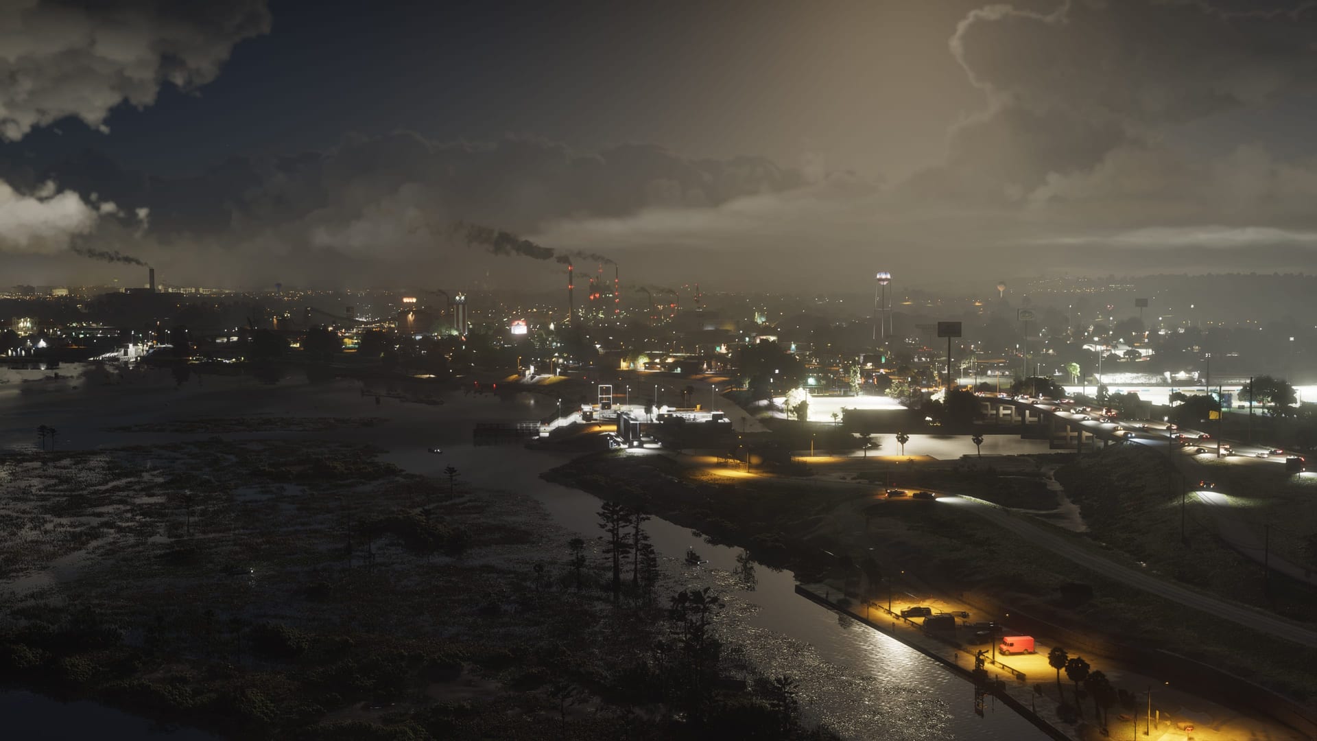
    The former vacation destination is defined by cheap motels, closed attractions, empty strip malls, painkillers, malt liquor, truck stops and dirt bikes rather than a major container port.

    Cheap motelsShut-down attractionsEmpty strip mallsDirt-bike culture

    Still unknown: Rockstar has not confirmed container heists, dock schedules, port-security systems or a commercial shipping simulation.

    Official GTA VI screenshot of Ambrosia
    Official screenshot
    Industrial heartlandOfficially named

    Ambrosia

    Industry, old-school values and biker influence

    Ambrosia sits in Leonida's heart. Rockstar explicitly connects its economy to the Allied Crystal sugar refinery and says a local biker gang supplies almost everything else.

    Allied Crystal refineryIndustrial employmentBiker presenceRural roads

    Still unknown: There is no official Ambrosia Heights luxury district, stock exchange sector, purchasable ranch or refinery business system.

    Official GTA VI screenshot of Mount Kalaga National Park
    Official screenshot
    Northern frontierOfficially named

    Mount Kalaga National Park

    Hunting, fishing and off-road country

    This national landmark reaches Leonida's northern border. Rockstar names hunting, fishing and off-road trails, with surrounding backwoods occupied by mystics and anti-government radicals.

    National parkHuntingFishingOff-road trails

    Still unknown: No summit height, observatory, ghost schedule, mine system or survival-property mechanic has been announced.

    What the Official Reveal Establishes

    Geographic range

    A state-spanning story reaches well beyond Vice City into islands, wetlands, a western-style forgotten coast, central industry and northern parkland.

    Environmental contrast

    The six profiles are designed as distinct social and ecological zones, not merely differently colored sections of one city.

    Activity signals

    Mount Kalaga explicitly names hunting, fishing and off-road trails. Other regions visually establish boats, airboats, dirt bikes and dense road travel without confirming full activity systems.

    Story connections

    Jason's Keys history, Brian's boat yard, Vice City's music scene, Raul's robbery network and Ambrosia's biker economy connect characters to different parts of Leonida.

    Missing scale

    No official source provides total area, drive times, road density, accessible interior count or the percentage of water versus land.

    How to Read a GTA 6 Map Claim

    A practical source hierarchy for screenshots, videos and fan reconstructions

    Published fact

    A name, description, platform page or screenshot caption published by Rockstar. These facts can anchor a guide without guessing.

    Visual observation

    A road, skyline or landmark visible in official media but not named. Useful evidence, provided the label stays descriptive.

    Community estimate

    A placement, distance or border reconstructed from perspective. Valuable research, but not official geography.

    Community Map: Useful, Not Official

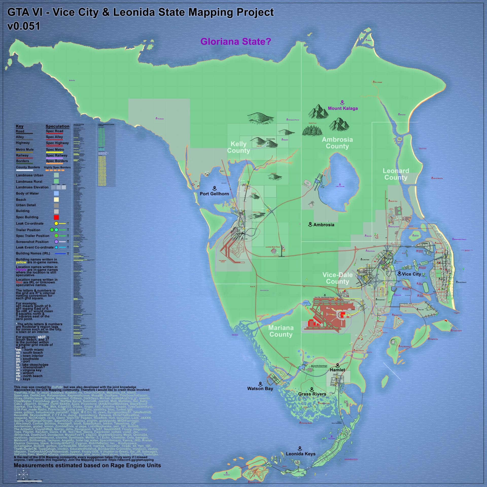
    Community reconstruction of the GTA VI Leonida map, version 0.51

    Version 0.51 community reconstruction

    Use it to understand one plausible arrangement of visible landmarks. Do not use its coastline, road lengths or blank spaces as proof of the final playable world.

    Open map viewer

    Continue Through Leonida

    Three focused guides answer different map questions without repeating this page

    GTA 6 Map FAQ

    Has Rockstar released the full GTA 6 map?

    No. Rockstar has published six named region profiles and official screenshots, but not a complete navigable map, boundaries, road network, scale bar or total land-area figure.

    What are the six confirmed GTA 6 regions?

    The official world material names Vice City, Leonida Keys, Grassrivers, Port Gellhorn, Ambrosia and Mount Kalaga National Park.

    Is the GTA 6 map bigger than GTA 5?

    Rockstar has not published a square-mile comparison or a statement establishing a precise size multiplier. Community maps can estimate layout, but they cannot confirm playable area or final scale.

    Are Vice-Dale, Leonard and Kelly official counties?

    No official Rockstar region page currently names those counties. They should not be presented as confirmed GTA VI geography.

    Can community maps still be useful?

    Yes, when clearly labeled. They can organize visible roads, skylines and repeated landmarks, but their distances, borders and unexplored spaces remain interpretive until Rockstar publishes a final map.

    Primary sources: Rockstar's Only in Leonida profiles, official screenshot library, and official location artwork. Checked August 8, 2026. Community-map elements are labeled separately.